 .back
.back
GA pilots are using VFR charts -which are termed 'Sectional VFR' in the USA- both to prepare a flight and to fly it along their route. Such VFR charts are provided with FS2002 Professional Edition. A unique scale, generally, provides a set of charts for a whole country. Such charts are not easy to find on the Internet, even with some sites providing them for the USA. The only other solution then, for the flightsim pilots is to turn towards bookstores who are selling such aeronautical charts. Even in that case, you will not neither easily find the VFR charts you will need for a flight in some exotic country, as those will need some rare and specialized bookstore. So, what? We personally found a fine, and useful solution as we are just using FS to provide for making useable such VFR charts. Your navigations then will become more realist. Like in the real world, it will be a easier flight when you will be able to check the landscape as seen from the plane to a chart. The VFR charts you'll be able to make will usefully be available thus to use with our innovative tutorial 'A Alternate Technique to the Computation of A Navigation in FS'
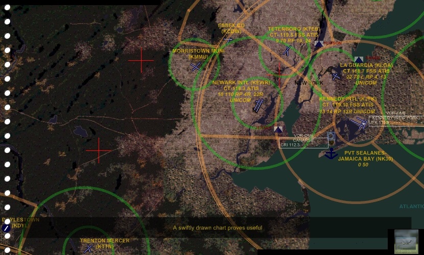 | 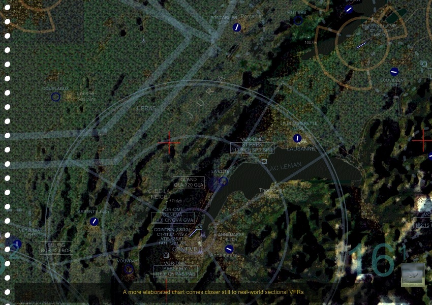 |
| click on thumbnail above to a illustration of sectional VFRs one can draw with FS2002 (part of a easy sectional VFR, left; part of a more elaborated sectional VFR, right) | |
The most easy way to go, generally, is to make one chart for one given navigation as that will not be time-consuming. Just grossly locate some airspaces and the references for the main terrains along the route, for example, and you are done! More elaborated charts which close nearer still to the real-world sectional VFRs will need more of your time. Such a demanding work however may prove useful, especially when you will have at your disposal a chart centered upon the terrain you are usually flying from
The technique we use for sectional VFRs on the fly is like follows. The description thus is refering to graphic tools we use with our system and each reader will have to adapt the tutorial to his own graphic softwares. The picture illustrating this tutorial is showing the result, as we are using too a set of shareware replacement textures for our FS2002
Now that the first part of the work is over, you are going to manipulate that image at the way of obtaining a more realistic chart and a one with a rupture enough which will attenuate the fact that it is not a real world one. For that just use a graphic software and play with the colors, saturation, etc. settings
The last step consists into to get all that better still. Personally, for example, we are adding the major aiports, with their class B airspace, one VOR or more as along the course we are displaying most of the lesser terrains. Like a conclusion, we save the picture into the .gif format for less weight. Note that, when you will be using that chart for preparing a navigation and saving that in .gif you might have some resolution loss, which is avoided by saving into .bmp, for example, and converting back into .gif
Website Manager: G. Guichard, site Flightsim Tutorials for FS2002 / Tutoriels flightsim pour FS2002, http://schoolsempire.netfirms.com/greece/indflight.htm. Page Editor: G. Guichard. last edited: 12/28/2010. contact us